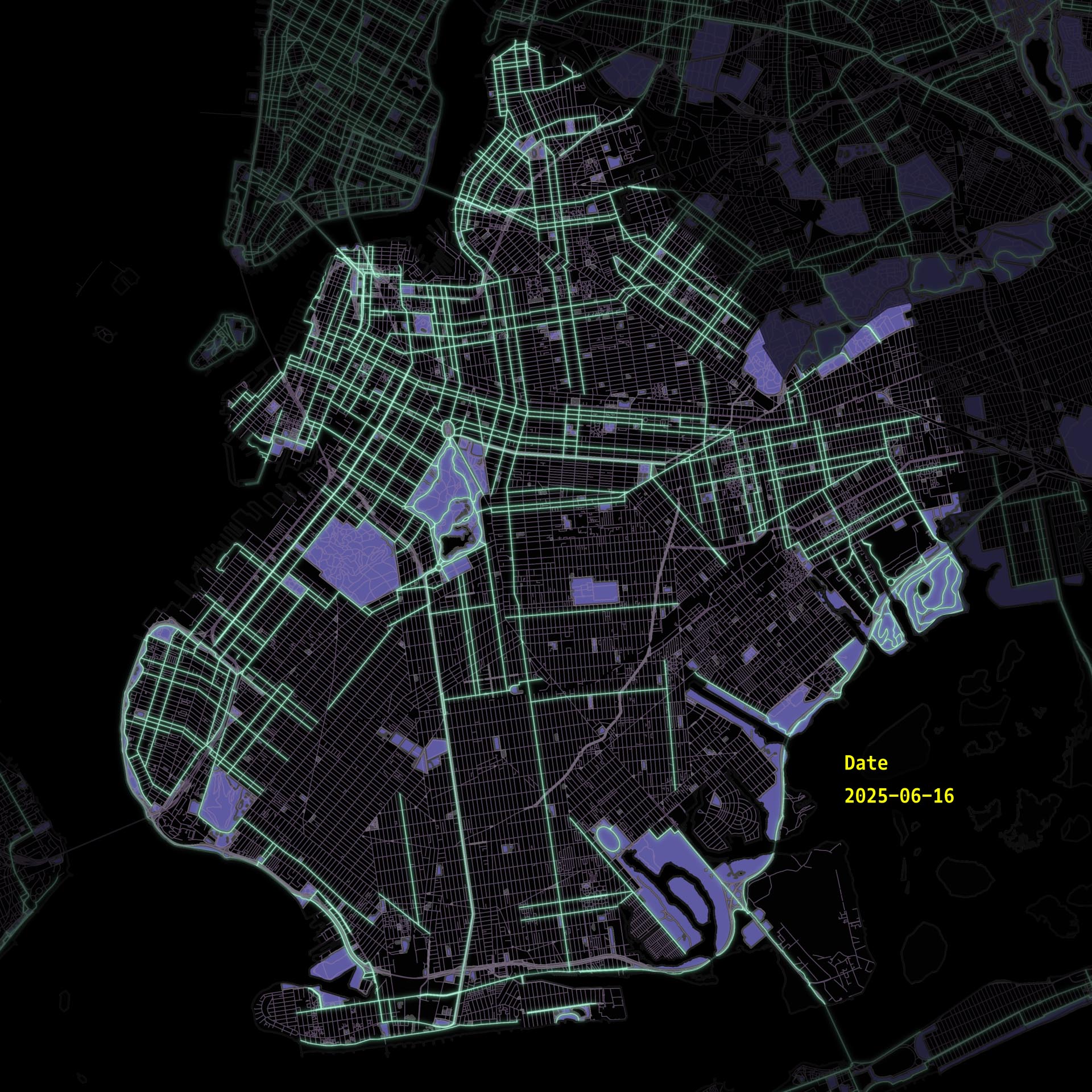
Look at those beautiful green lines, interlocking so densely to protect cyclists from any harm that might come to them!
But beneath the surface of this new network lies a ghost map- a history of crashes that tells a different story.
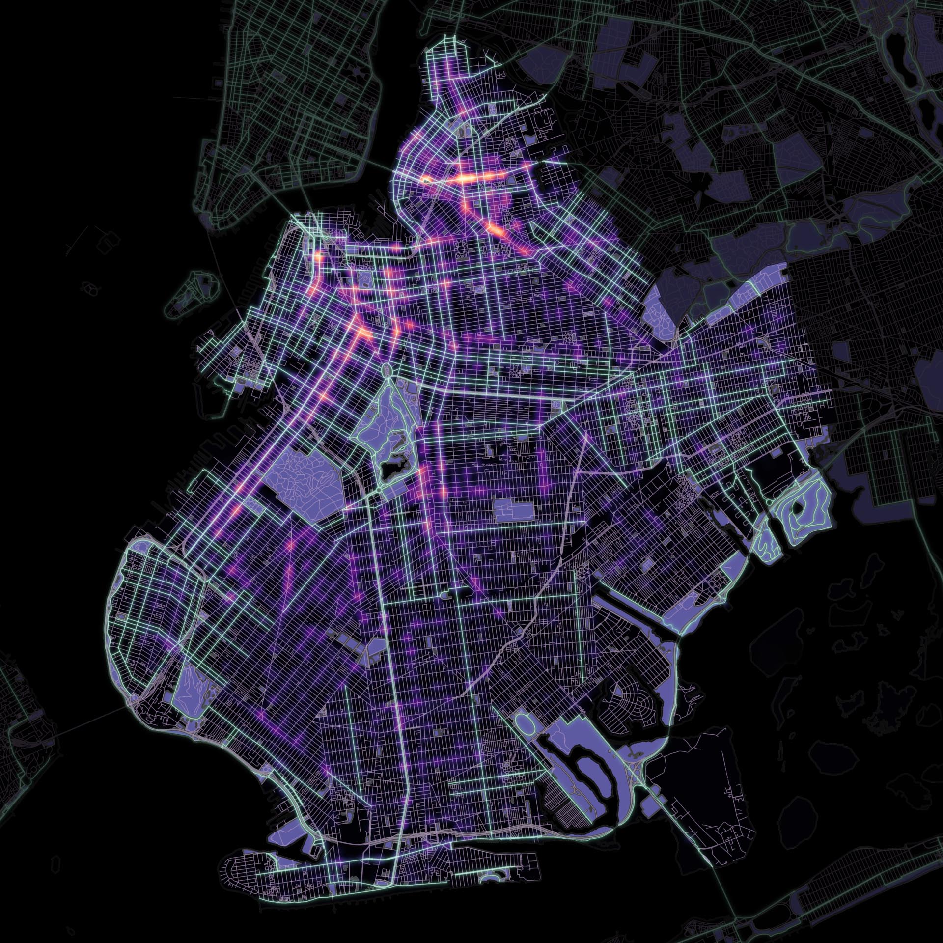
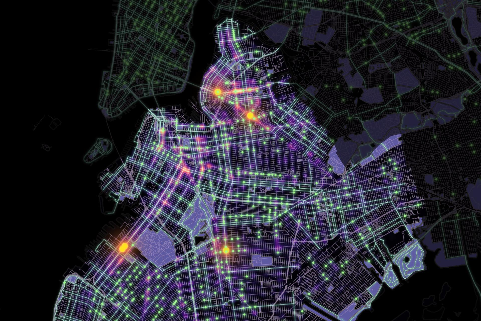
This is a heatmap of cyclists injuries and deaths from July 2012 to June 2025 from NYPD data. That's 18,455 injuries, and 71 deaths, an average of 4 injuries per day.
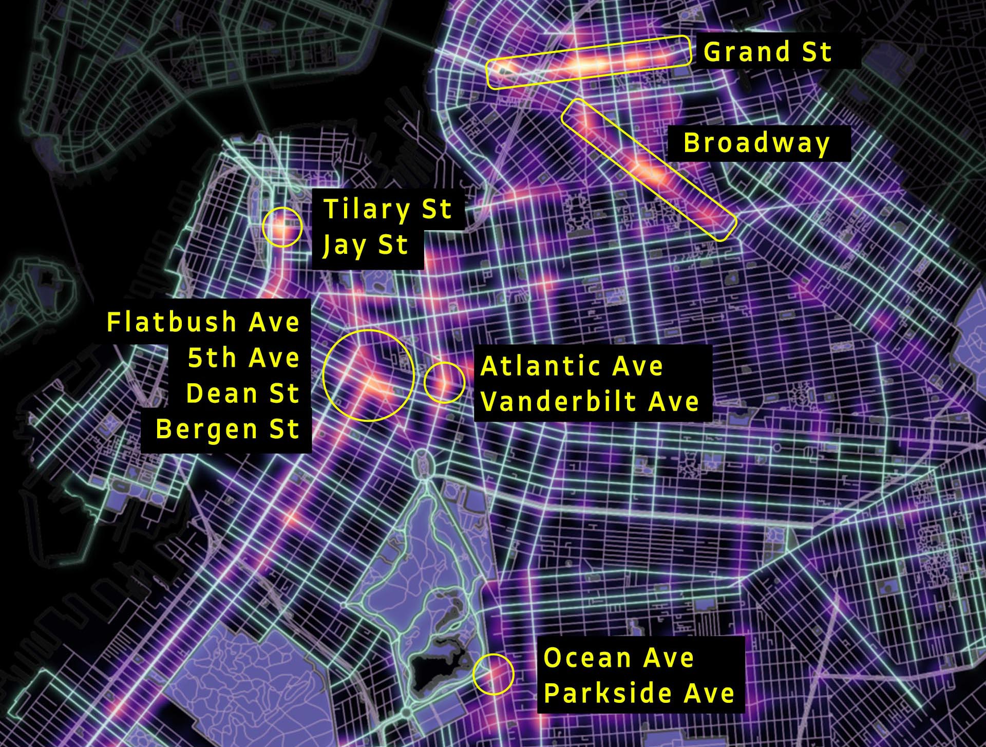
Here are some of the zones with a lot of crashes
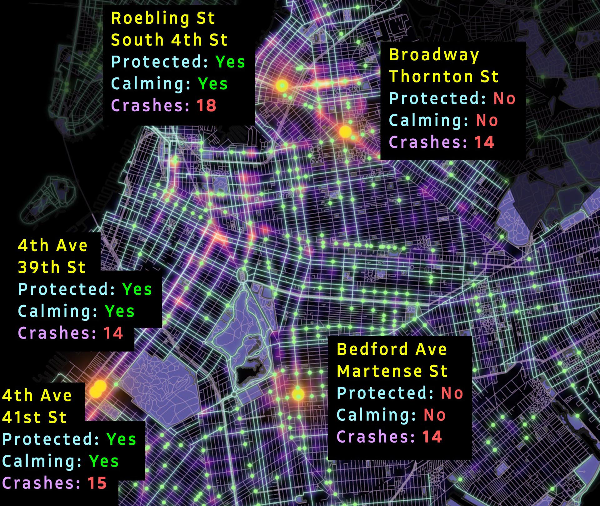
Most of these zones have bike lanes. Only the Broadway zone doesn't. But it shows that bike lanes alone don't solve the problem.
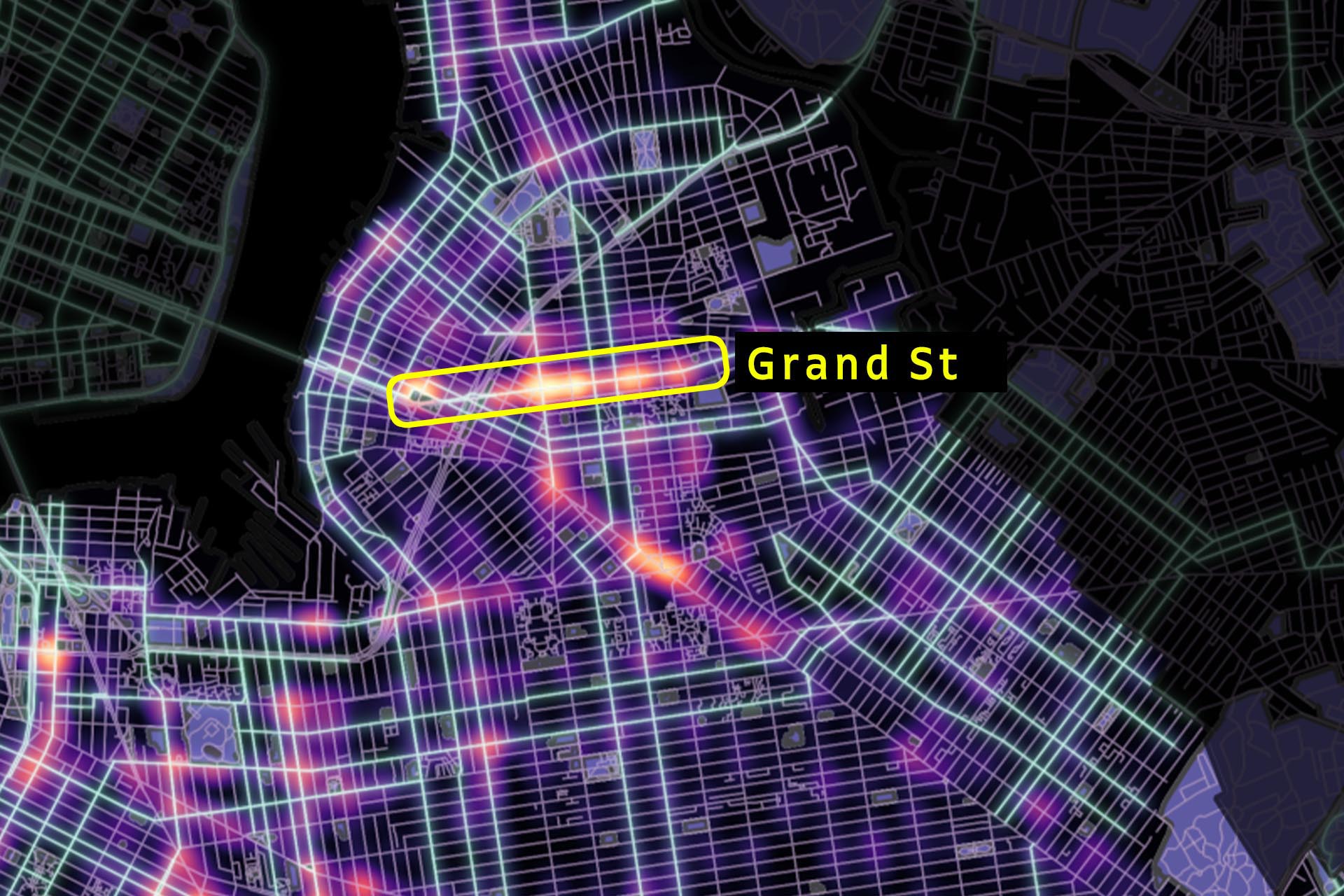
The Grand Street bike lane provides a good example for why crashes continue to occur despite having a heavily protected bike lane, let's take a closer look.
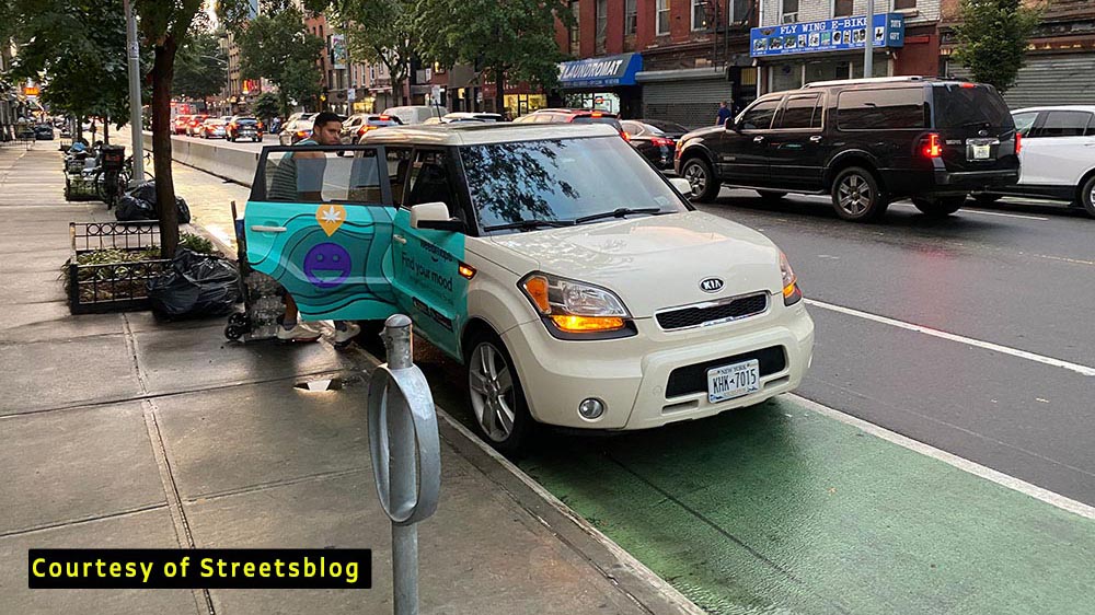
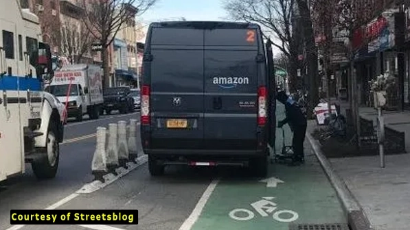
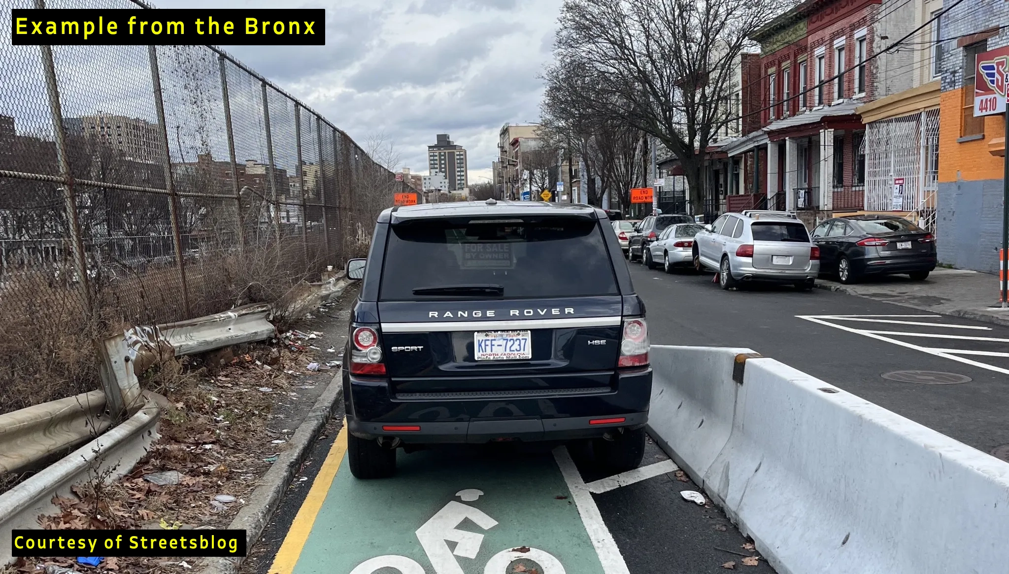
This is what the old unprotected bike lane looked like. To drivers, the green color of the bike lane was too tempting not to park on.
After years of delays, the NYC Department of Transportation installed some bendy sticks to increase protection in 2020, That didn't help.
Concrete barriers were installed in 2022. vehicles just parked at the edge anyway, blocking riders and sometimes forcing them to enter the road lane.
It's actually kind of darkly funny.
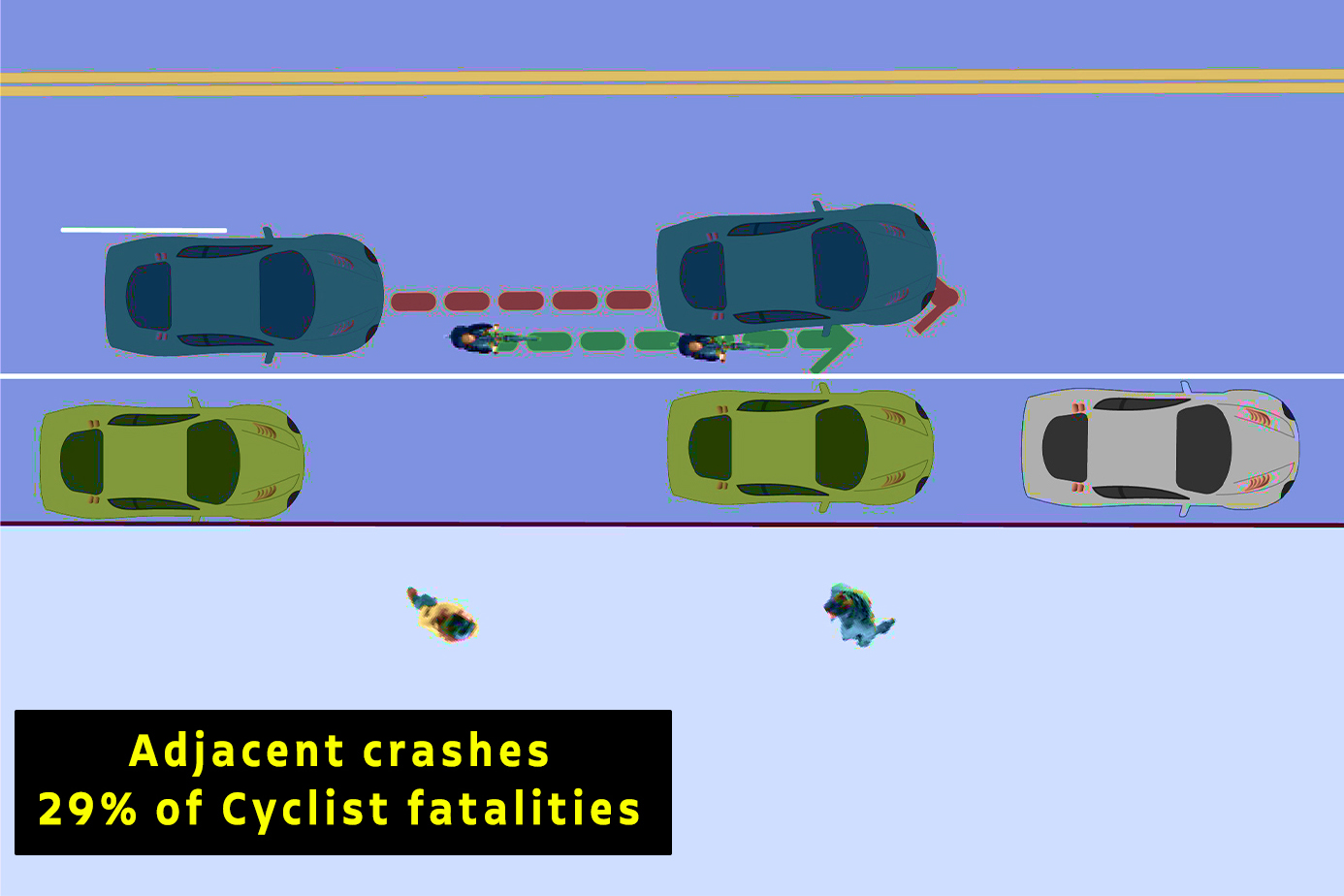
This causes what the DoT calls adjacent crashes.
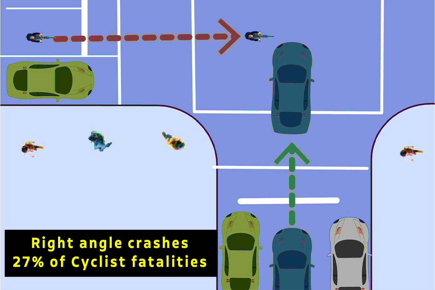
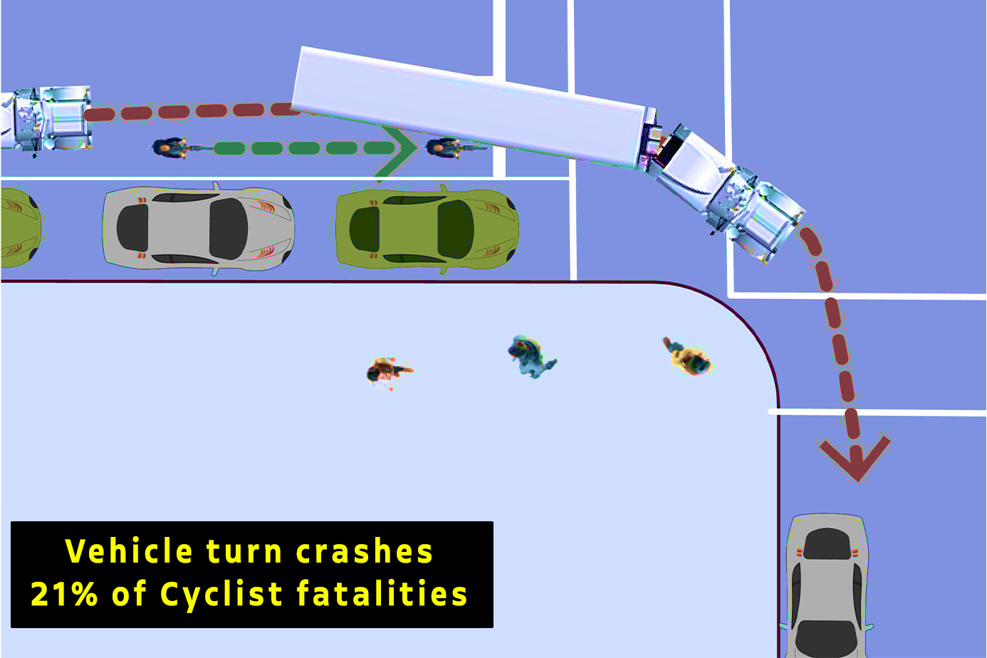
89% of crashes happen at intersections.
This includes adjacent crashes, as well as right angle crashes.
And also vehicle turn crashes. (My least favourite, personally.)
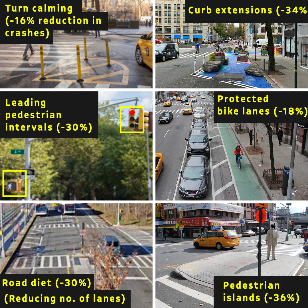
In a city of grids, there is no choice but to find ways to make intersections safer.
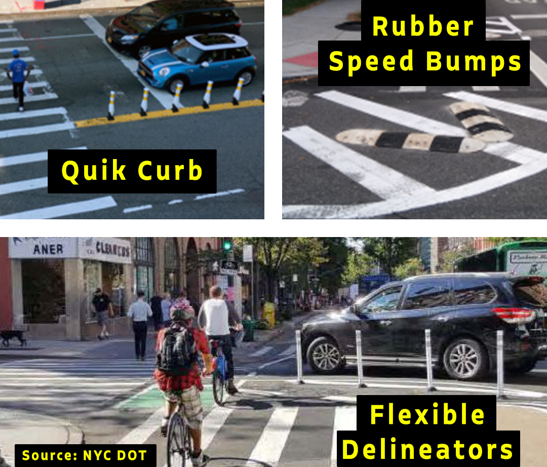
Since 2016, the NYC DoT started building "traffic calming measures" to slow down road users and increase visibility while turning.
I don't have cyclist specific data, but I can say from experience that they force cars to slow down and keep them from cutting corners at high speeds.
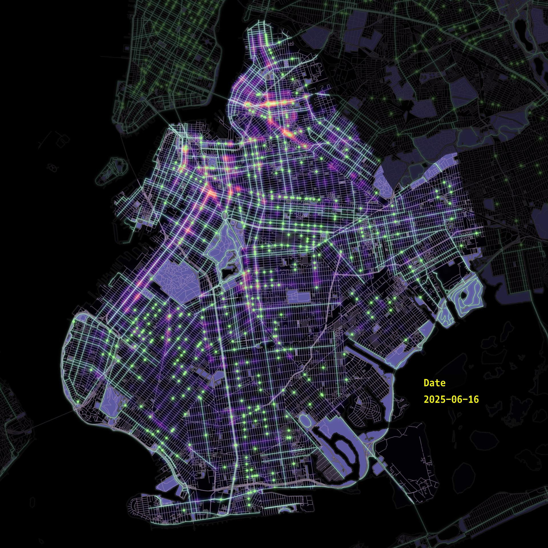
Here are all the locations in Brooklyn.
A recent DoT study showed that a variety of measures are required to reduce crashes. Ultimately, the things that makes pedestrians safe are also the things that can make cyclists safer.
So for now, riders have to be alert and ride carefully.
Here is a map of the worst intersections in the last 5 years.
Here are some stats. As you can see, crashes can occur on a wide variety of streets.
Once you're adequately scared, come ride some of them with me so you don't have to by yourself!
This is Bedford Ave and Martense St in Flatbush.
I've had a really close call here before, and you can see why, it's a major road, no protection, and cyclists probably have to ride around the bus when it's at the bus stop.
This is Broadway and Thornton at the Broadway Triangle.
No bike lane here, an infamous (for blocking bike lanes) Piece of Cake Moving truck is parked here, the intersection is at an awkward angle, making it easier to misjudge the situation. The train track pillar is also blocking the view to look right.
This is 4th Ave and 41st Street in Sunset Park.
4th Ave is wide, and well known for cars making turns at high speeds. Cyclists' and drivers' view of each other is blocked by the parking protected bike lane. The recently installed empty space helps visibility, but they are usally used as illegal parking spaces.
This is Roebling St and South 4th St in Williamsburg.
I think the issue here is cyclists don't really want to stop here on red lights. There's also some very hard to spot rubber speed bumps on Thornton St. But this is a weird one.
So this is the worst of the worst of Brooklyn's Bike infrastructure.
America's best large city for cycling!